
Sir,
Last Friday (1st July) Monmouthshire County Council passed the Local Development Plan for the county. This includes the provision of 400 new houses off Wonastow Road.
Much of the debate concerned the problem of flooding as the site was mostly on the Monmouth floodplain.
However, the chief planning officer George Ashworth, in front of the full council and many protesters from Monmouth, emphatically denied that the area was part of the floodplain.




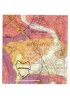
The accompanying map, which is based on the official Geological Survey of Great Britain, confirms that not only is the site on the floodplain but that it is on the alluvium, which is the lowest geological level of the floodplain.
Crown Copyright. All rights reserved; Monmouth Archaeology Licence No 10041477.
Stephen Clarke MBE
(Monmouth)